Lost Medieval Town at Hamar Uncovered: Excavation Confirms GPR Data
In the summer of 2023, the Norwegian Institute for Cultural Heritage Research (NIKU) pinpointed the location of the long-lost medieval town of Hamarkaupangen using grond penetrating radar (GPR). During an ongoing excavation carried out by NIKU and Anno Museum, archaeologists have finally found physical remains of buildings, confirming the geophysical data.
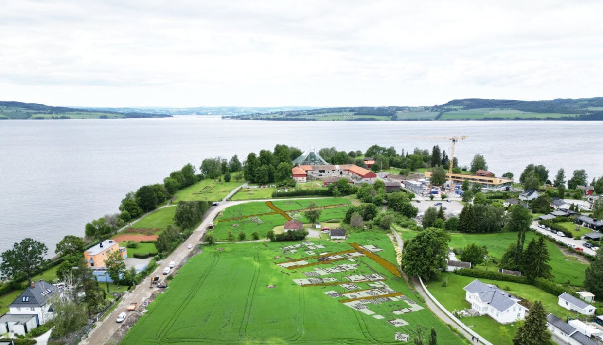
In 2023 and 2024, NIKU conducted GPR surveys at Kringkastingsjordet, on the Domkirkeodden site, commissioned by Domkirkeodden/Anno Museum. The aim of the survey was to locate the medieval market town of Hamar.
Where is Hamarkaupangen?
According to the The Chronicle of Hamar (16th century), an urban settlement once lay to the east of Hamar’s cathedral and episcopal residence. The town was likely established around the mid-11th century, but it is unknown when it was abandoned. Of Norway’s eight known medieval towns, it is the only one located inland.
While artefacts have been found in the topsoil over the years, the physical evidence of this medieval town – its buildings, town plots, and streets – has remained elusive.
So, where exactly was this town located? Was there really a town at Domkirkeodden, or was it merely a seasonal trading site?
Over the past decade, NIKU has repeatedly used GPR to investigate the fields at Domkirkeodden. This time, the evidence they sought finally appeared.
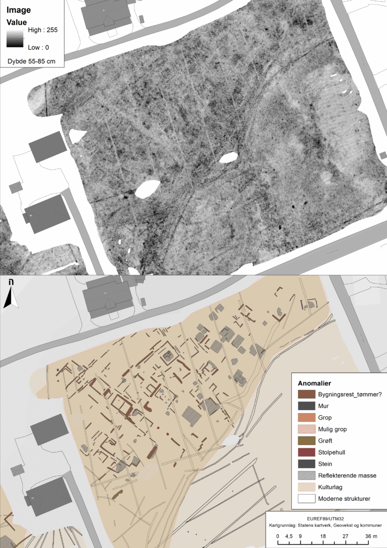
The GPR results revealed urban-like features with clusters of buildings, narrow passageways, and street alignments, indicating that the town has finally been discovered.
Digital Archaeology at NIKU
For a number of years, NIKU has worked with the implementation of archaeological geophysics in Norway and the Nordic region. This work has been led by Dr. Knut Paasche in NIKU’s Department of Digital Archaeology.
The radar has been developed by Guideline Geo, and the technology surrounding the radar itself and the software has been developed in collaboration with several international partners organized in the Ludwig Boltzmann Institute for Archaeological Prospection and Virtual Archeology (LBI ArchPro).
Ground-Penetrating Radar as the Key
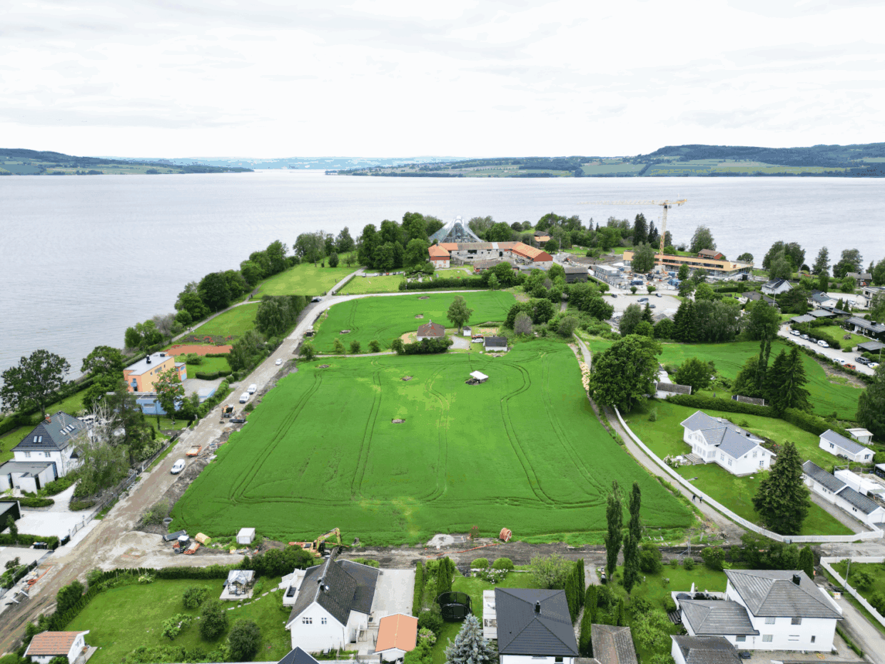
NIKU’s department of Digital Archaeology carried out the GPR surveys on the Domkirkeodden site, including the Kringkastingsjordet field. This field is situated to the east of the cathedral and bishop’s residence. While this area has long been suspected as the site of the secular settlement, archaeological proof of an actual town has remained absent—until now.
A 16-channel motorised ground-penetrating radar system from Guideline Geo was used for the survey. This is the same equipment that identified the Viking ship at Gjellestad in 2018.
Guideline Geo/ MALÅ
Leading Swedish based technology company with focus on geophysical measurement equipment and is a supplier of GPR technology.
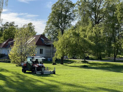
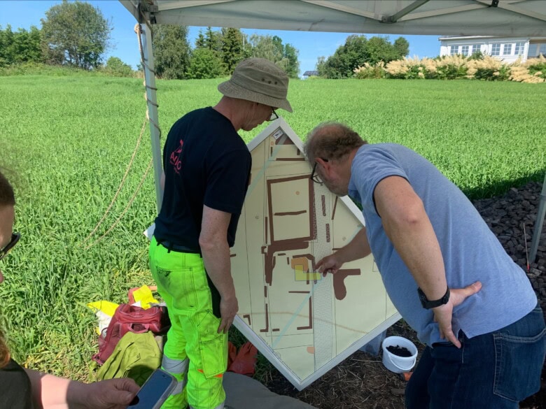
The geophysical survey was carried out by archaeologists Monica Kristiansen, Jani Causevic, and Ole Fredrik Unhammer. The survey itself was carried out in one day, however, interpreting the entire dataset took several weeks. Then again, it’s not every day one discovers an entire town.
The radar data revealed features characteristic of urban structure, comparable to those in other known Norwegian medieval towns: clusters of buildings, narrow alleys, and streets. Multiple structures are visible in the dataset, and in some places, details suggest the presence of two-room dwellings with corner hearths.
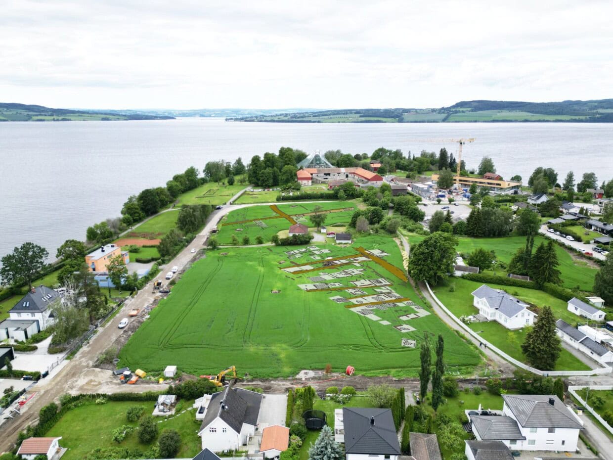
Finally confirmed The GPR results show clusters of buildings, narrow passageways, and street alignments typically for Norwegian medieval towns. The data has now been confirmed. Photo: Jani Causevic, NIKU. GPR image: Monica Kristiansen, NIKU.
Research Excavation to Confirm the GPR Results
A research excavation funded by Anno Museum at Domkirkeodden was initiated to test whether the radar-identified features truly were the remains of the medieval town of Hamarkaupangen.
The excavation aims to investigate one of the presumed structures identified in the 2023 GPR data.
Under an one-meter-thick layer of cooking stones, archaeologists are now uncovering timber remains – walls and floorboards – that confirm the interpretation of the radar signals as traces of timber buildings.
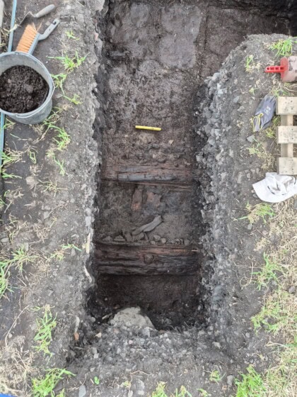
The structure in question, interpreted from the geophysical data as a two-room dwelling, contains timbered walls and plank flooring from multiple construction phases. The team is now searching for a hearth.
A Glimpse of a Lost Town
The wooden elements lay exactly where the radar had indicated and heavily support the interpretation of a timber-built building. Even though this excavation reveals only a small section of a building, it forms a crucial part of the broader urban landscape evident in the radar data.
These structural remains strongly reinforce the hypothesis that Hamarkaupangen featured timber buildings arranged in a town-like layout.
The coming weeks may bring further discoveries, and potentially dating evidence, to clarify the historical context of the site.
A sample of the timber has been sent to Uppsala for radiocarbon dating. The archaeologists expect results next week.
Small Excavation – Big Results
Archaeologist Monica Kristiansen, who interpreted the radar results, expressed both excitement and caution:
“We were eager to see what lay below ground. The thick layers of cooking stones presented a new context for us – we had no prior experience of how these stone-filled layers might affect the visibility of wooden structures in the GPR data. Moreover, preservation conditions for organic materials in this area are generally poor, so we expected the remains of the timber buildings to be in poor condition. It is therefore extremely encouraging that the radar interpretations are being confirmed!”
The excavated area covers only four square metres, yet it has already yielded significant results in the search for Hamarkaupangen.
Both wall timbers and flooring have been confirmed – an encouraging sign for future investigations across the site.
The layer of cooking stones at the excavation site is up to one metre thick, making the work physically demanding. Yet beneath this stone layer, traces of a long hidden medieval town are beginning to re-emerge — a testament to the power of geophysical methods, patient investigation, and the enduring questions posed about Norway’s medieval past.