What is left of the Gjellestad Ship?
Next week archaeologists will open trenches at the site of the Gjellestad Ship.
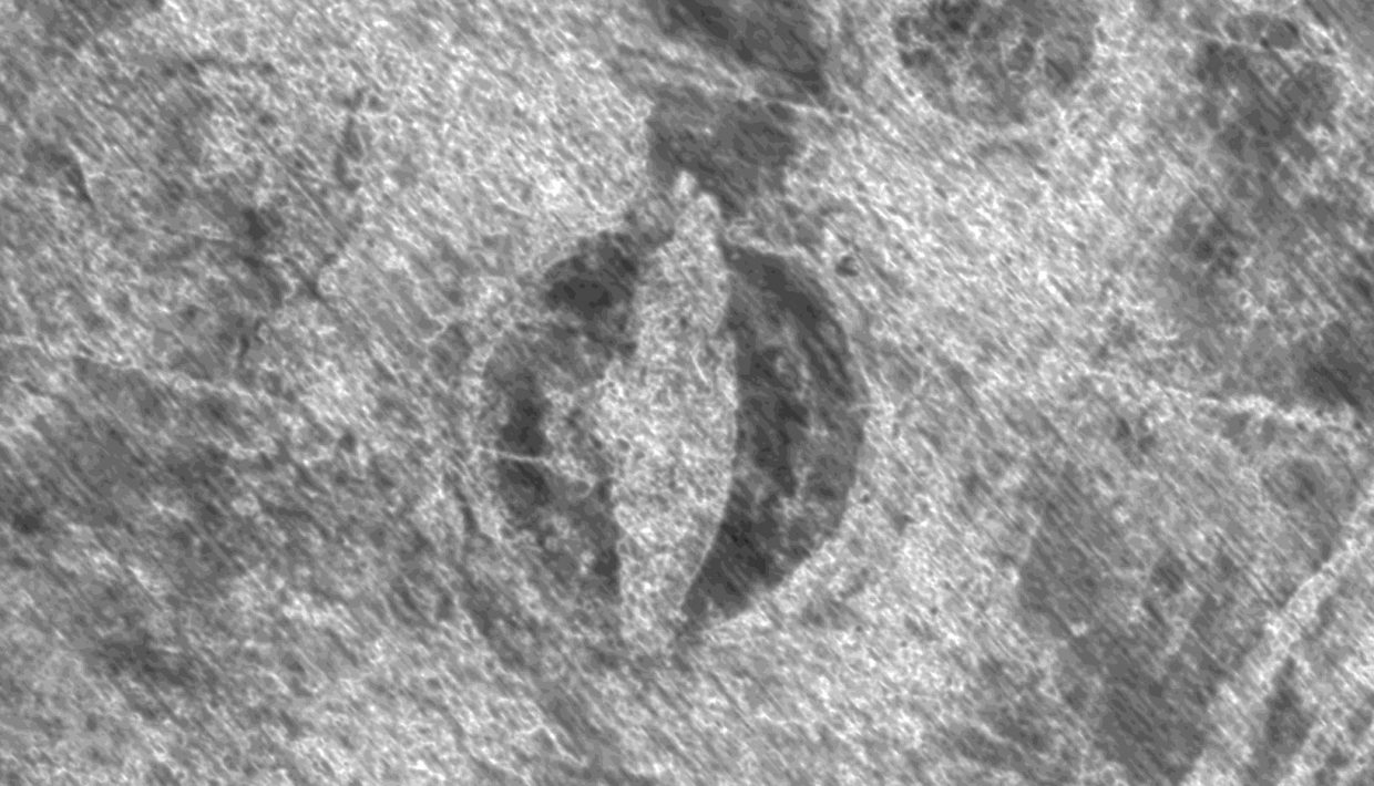
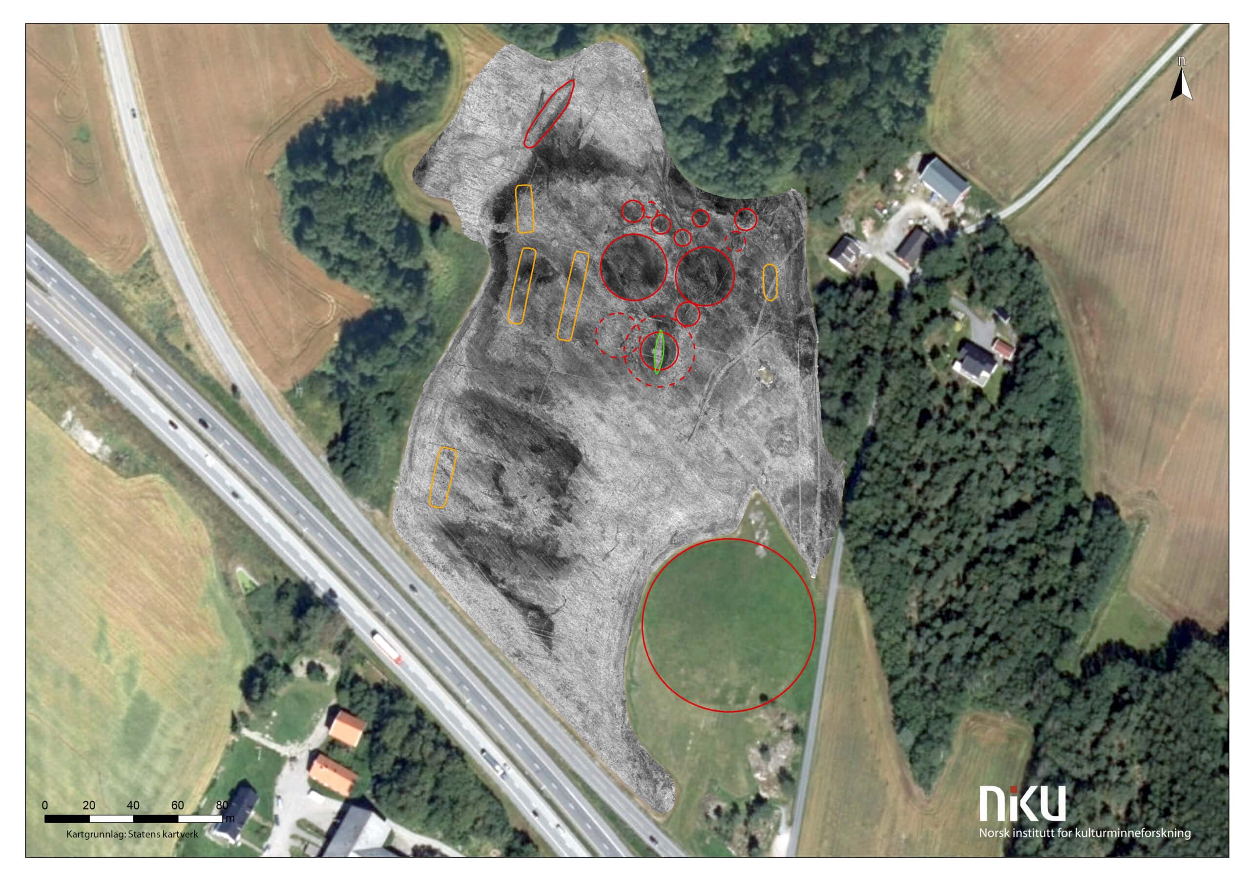
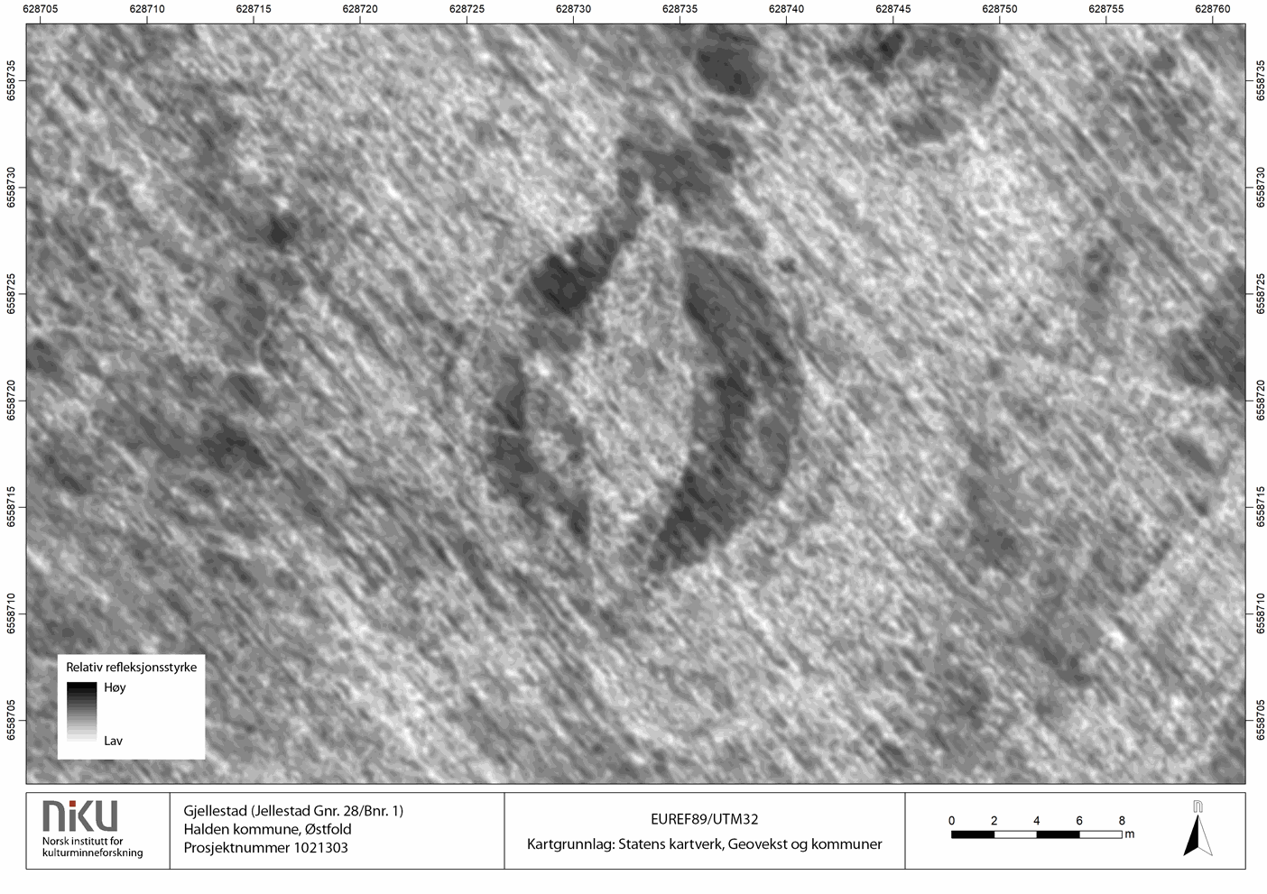
In October 2018, national and international attention was directed at the Gjellestad Ship found with the help of Georadar. Next week archaeologists from the Museum of Cultural History (UiO) and the Østfold County Municipality will conduct invasive investigations at Gjellestad.
The goal of the two-week excavation is not a total investigation of the site but to clarify the state of any possible remains of the ship, and to extract dateable material from some of the features uncovered. Limited investigations will be carried out at two locations within the ship mound, according to a press release by the museum.
– This is extremely exciting. We hope to clarify the connection between the settlement site and the ship grave. Here the dating is important, in order to clarify whether it was a large site existing at one specific period or if they stem from different time periods, says archaeologist Sigrid Mannsåker Gundersen, project manager for Østfold County Municipality in the press release.
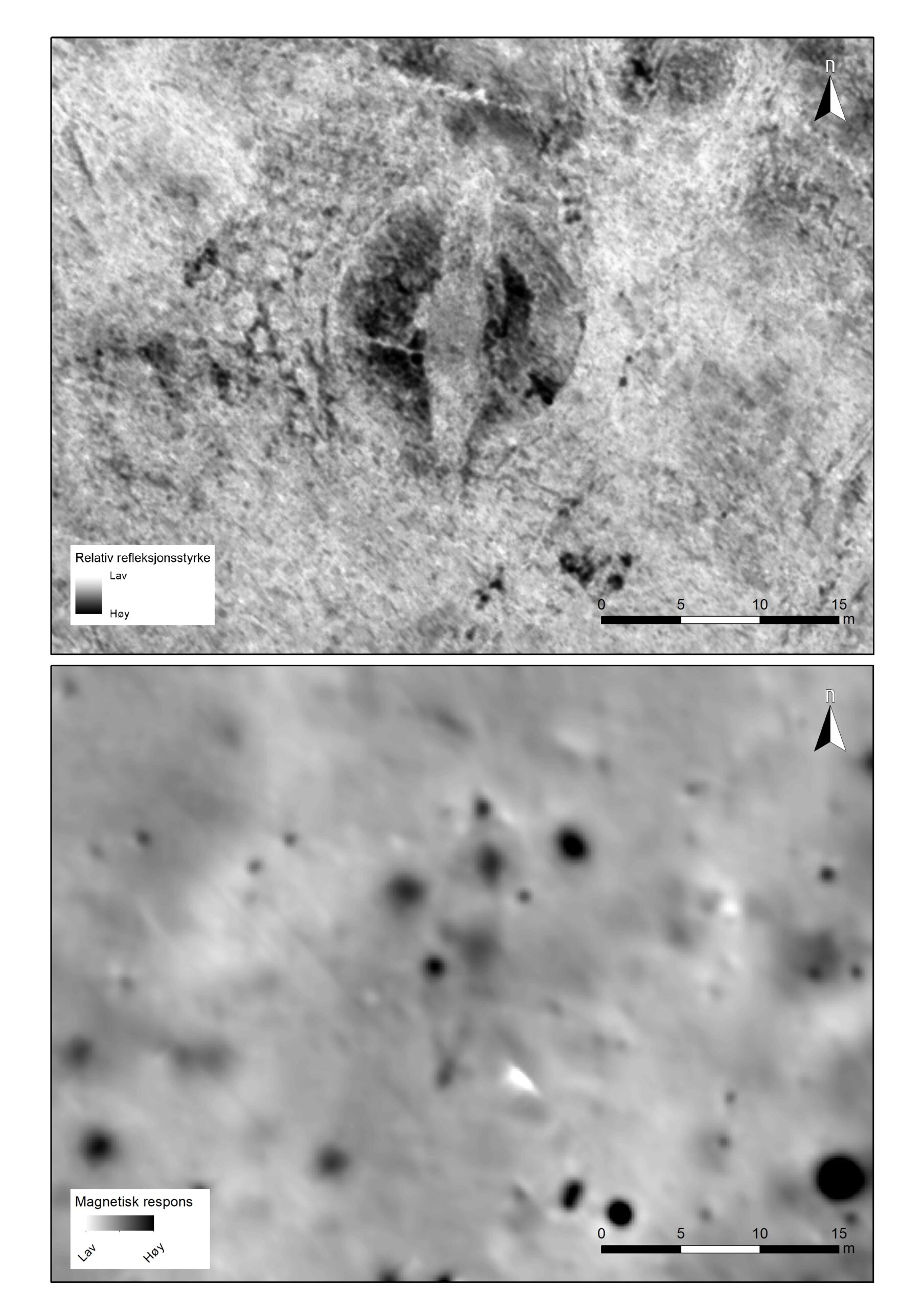
It was a motorized high resolution georadar system developed by the LBI ArchPro research project and run by the Norwegian Institute for Cultural Heritage Research (NIKU) that made the spectacular discovery in 2018.
– This is an incredible discovery, and we are all equally excited about discovering if anything solid is preserved in the ground. For us, it is also important to have the findings confirmed and, in this way, learn more about geophysical investigations as an archaeological method, says Dr. Knut Paasche head of department for Digital Archeology at NIKU.
Main project page: The Gjellestad Ship
Hoping for new information on Viking ships
With a doctorate on Viking ships, Paasche is interested in the excavation regardless of how much or little is preserved form the ship. He is optimistic about what new knowledge that will resurface from this excavation.
– After all, we only have a handful of well-preserved ship finds from before. When we think that once thousands of such ships must have sailed along our coasts, all new information we can get is very important to understand the ships and not least this whole period of Norwegian and Scandinavian history, says Paasche.
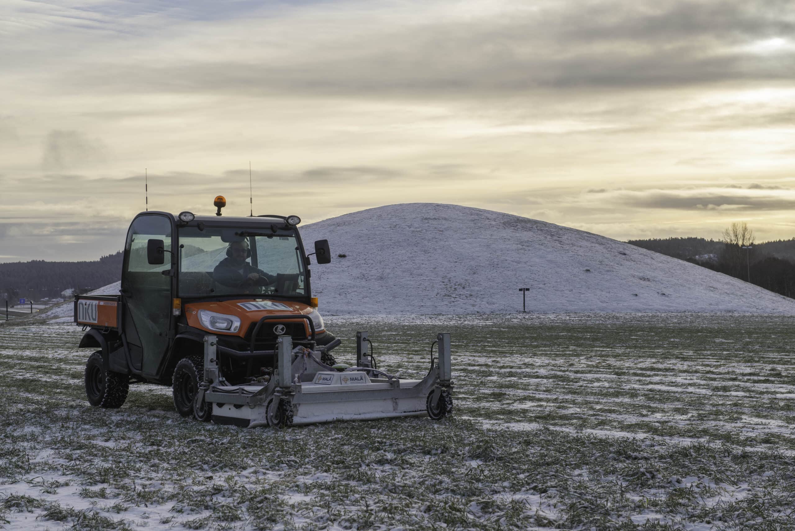
Winter surveys at Gjellestad
During the winter months, researchers from NIKU ran further georadar surveys, this time on the snow-covered ground. They also investigated the area with a magnetometer system.
– We had good results here too, but they did not generate much additional details about the find, says Paasche, who is looking forward to following the work for the next two weeks.
Hoping to survey the wider landscape using georadar
Paasche and his colleagues also aim to survey the landscape around the burial mounds. They believe there might be a trading post or settlement nearby.
The relatively small area already investigated now holds five long houses, 11 burial mounds, a ship’s mound and not least the monumental Jell Mound. That makes this particular area with its surroundings an incredibly exciting area for further archaeological research.
– We know the coastline has stood around 4.5 meters higher and thus further into the country in the Viking Age, we should not ignore that the bottom of the fjord arm may be hiding a harbor or trading place in the Viking Age. Imagine if we could find this as well, says Paasche.
There will be daily briefings for the press at Gjellestad at 14 pm every day during the excavations.