Cultural monuments in Iceland are threatened by volcanoes – NIKU helps secure knowledge
Volcanic activity on the Reykjanes peninsula in Iceland threatens several protected archaeological sites. In recent weeks, NIKU has been working hard together with the Icelandic National Heritage Board (Minjastofnun Íslands) to ensure solid digital documentation of three sites in danger of being covered by lava.
-These cultural monuments are a non-renewable resource. It is therefore important that they are properly documented for posterity, says Knut Paasche, head of NIKU’s department for Digital Archeology.
Eruptions every thousand years
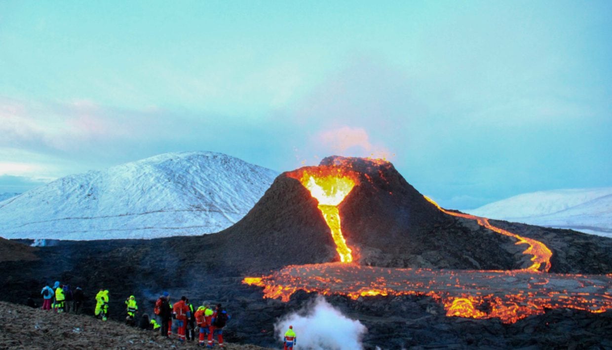
Geological and historical data show that the volcanic system under Reykjanes erupts every thousand years. The last volcanic activity on the Reykjanes peninsula began in the 11th century and ended in the 14th century. Written sources tell of a powerful eruption between 1210 and 1240. Ash and solidified lava particles were carried by the wind, creating problems for the livestock in the area.
The sites where these domestic animals and their owners lived are now in danger of disappearing into a new lava flow from the volcano on Fagrafjall. This flow will probably cover the archeological sites including church ruins, longhouses, barns, entire farms and fishing villages.
No one knows how long the lava eruption on Reykjaneset will last. It can stop “soon”, which in a geological sense can mean anything from next week to three hundred years from now. The Icelandic National Heritage Board is therefore not willing to wait too long.
-If the lava continues to flow for a while longer, the cultural monuments will disappear forever, says Paasche.
These sites can disappear forever
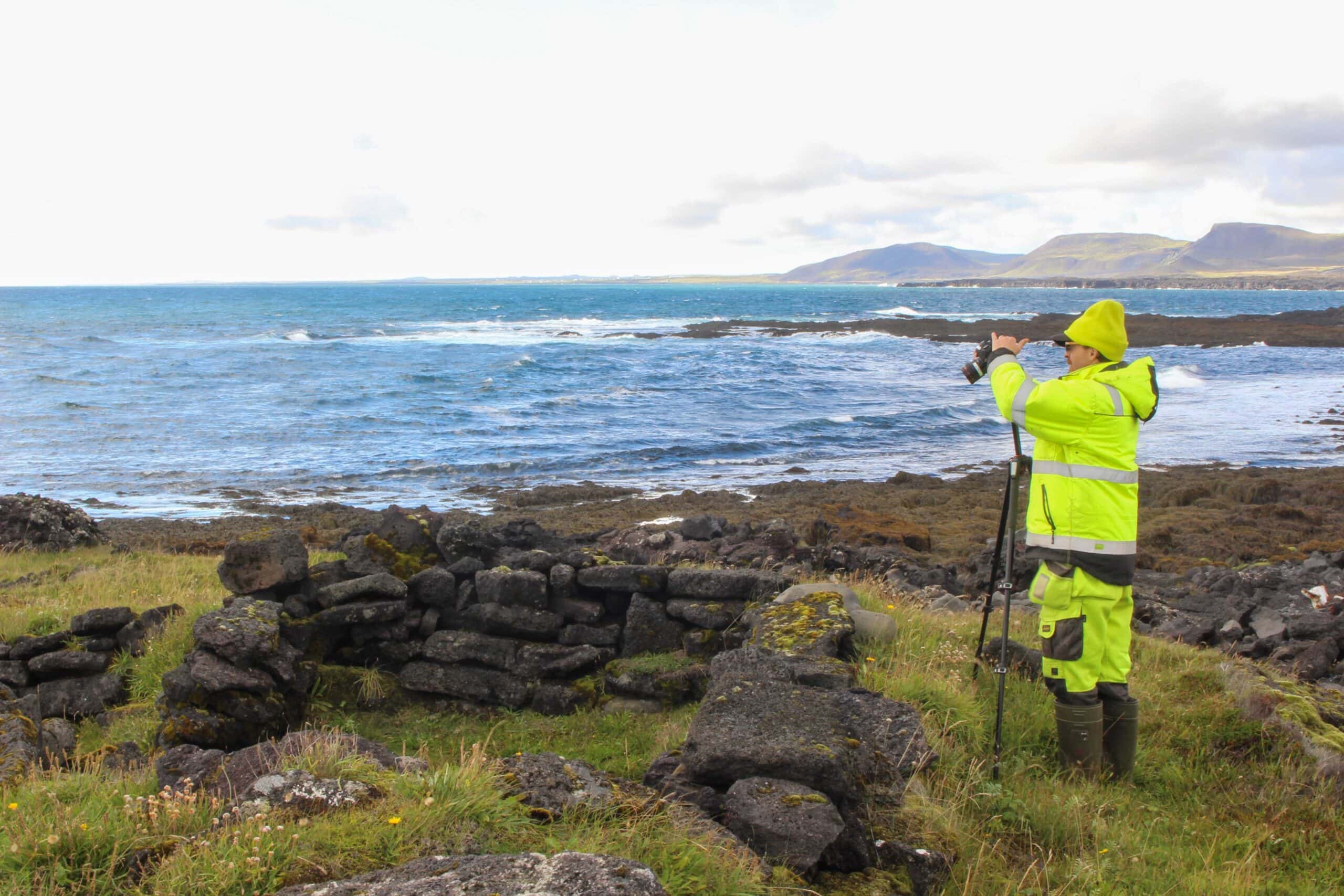
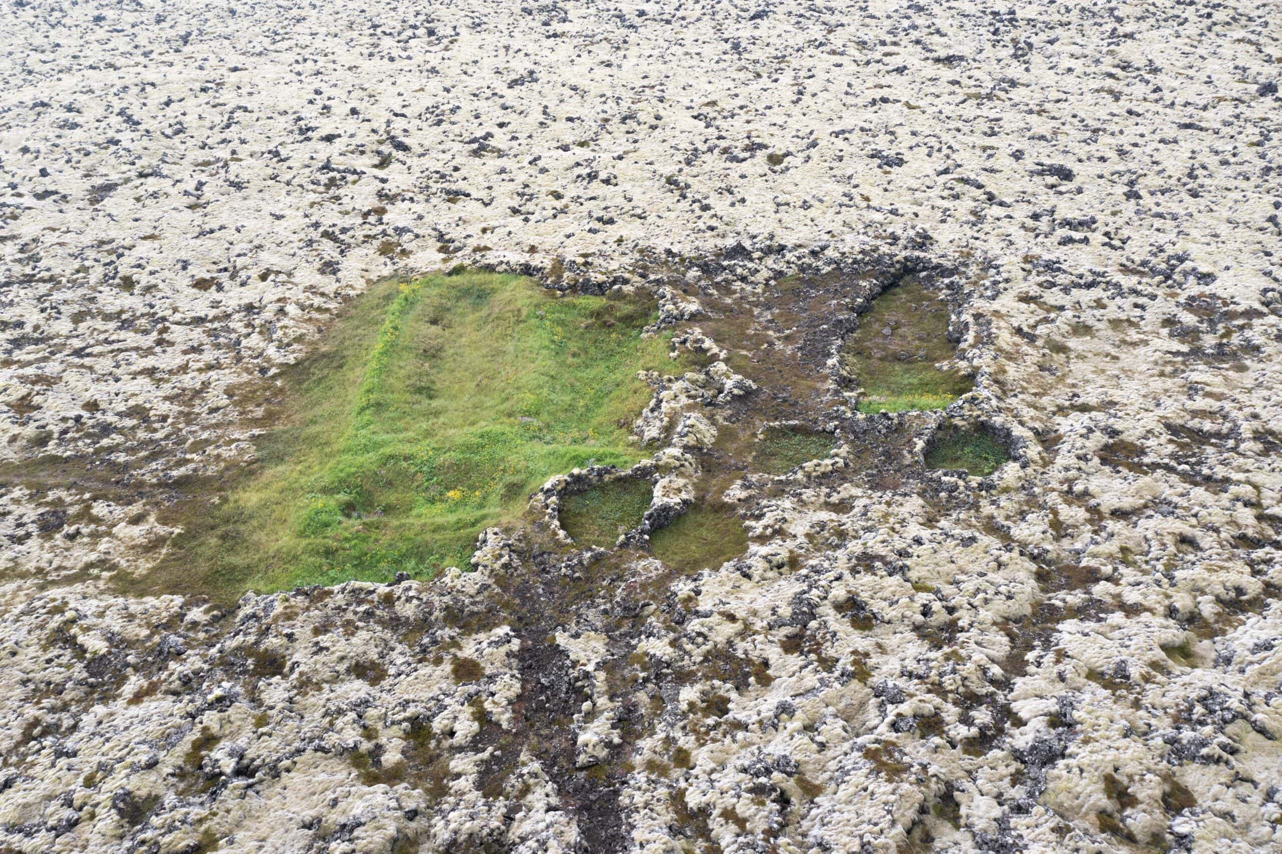
Selatangar is an elongated fishing village that has been in use from the Middle Ages until the 19th century. It consists of over 20 dwellings, including buildings for people and animals. There is also a smithy and small fish houses “fiskbyrgi” for drying fish.
Tyrkjabyrgin (Eldvörp) consists of ruins of small houses and fiskibyrgi, located in a remote lava field. It has long been thought that this was a hiding place for outlaws or a place where people from the town of Grindavik would flee if the Turks came to rob people, as they did in the 17th century. Today we believe that these ruins are much older.
‘Húshólmi (Gamla Krýsuvík) is a farm with longhouses, a church, barns and several dwellings, which were evacuated around 1150 after lava from a volcanic eruption partially covered the farm.
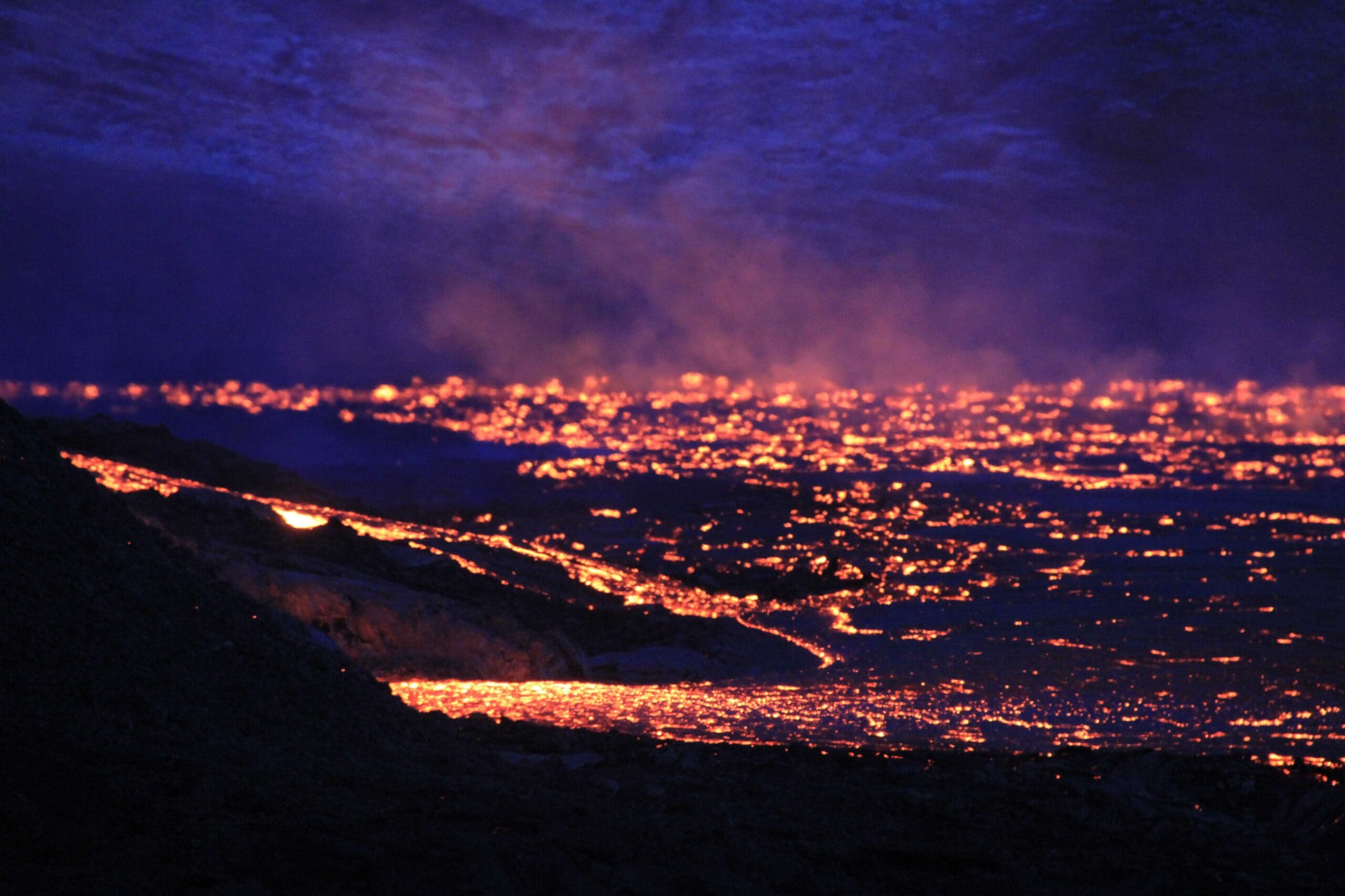
The lava flows in the direction of cultural monuments
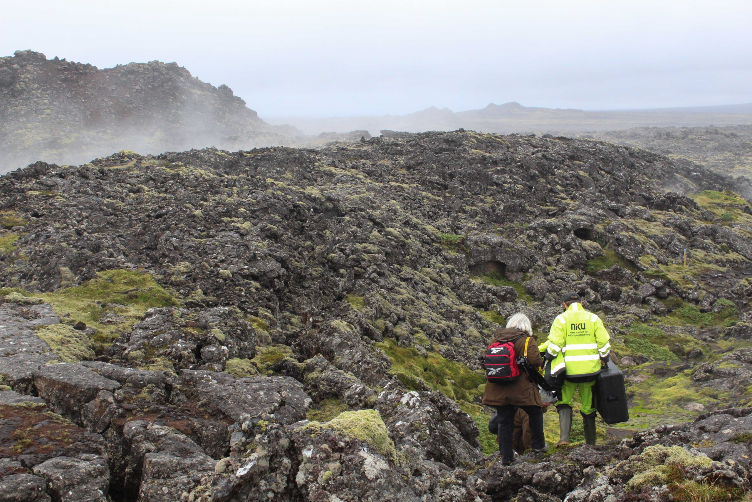
– Every day, thousands of cubic meters of lava flow into the landscape, says Dag-Øyvind Solem, NIKU’s archaeologist and drone pilot. He has worked on several similar projects in Iceland in collaboration with the Icelandic archeology company Antikva ehf.
Solem has dragged a ten-kilo drone case through the solidified lava landscape, at a safe distance from the glowing lava. In addition to the challenges of accessibility, there are also problems with the weather.
– The biggest challenge for the assignment has been to get enough breaks from wind and rain to get enough pictures from the air, says Solem.
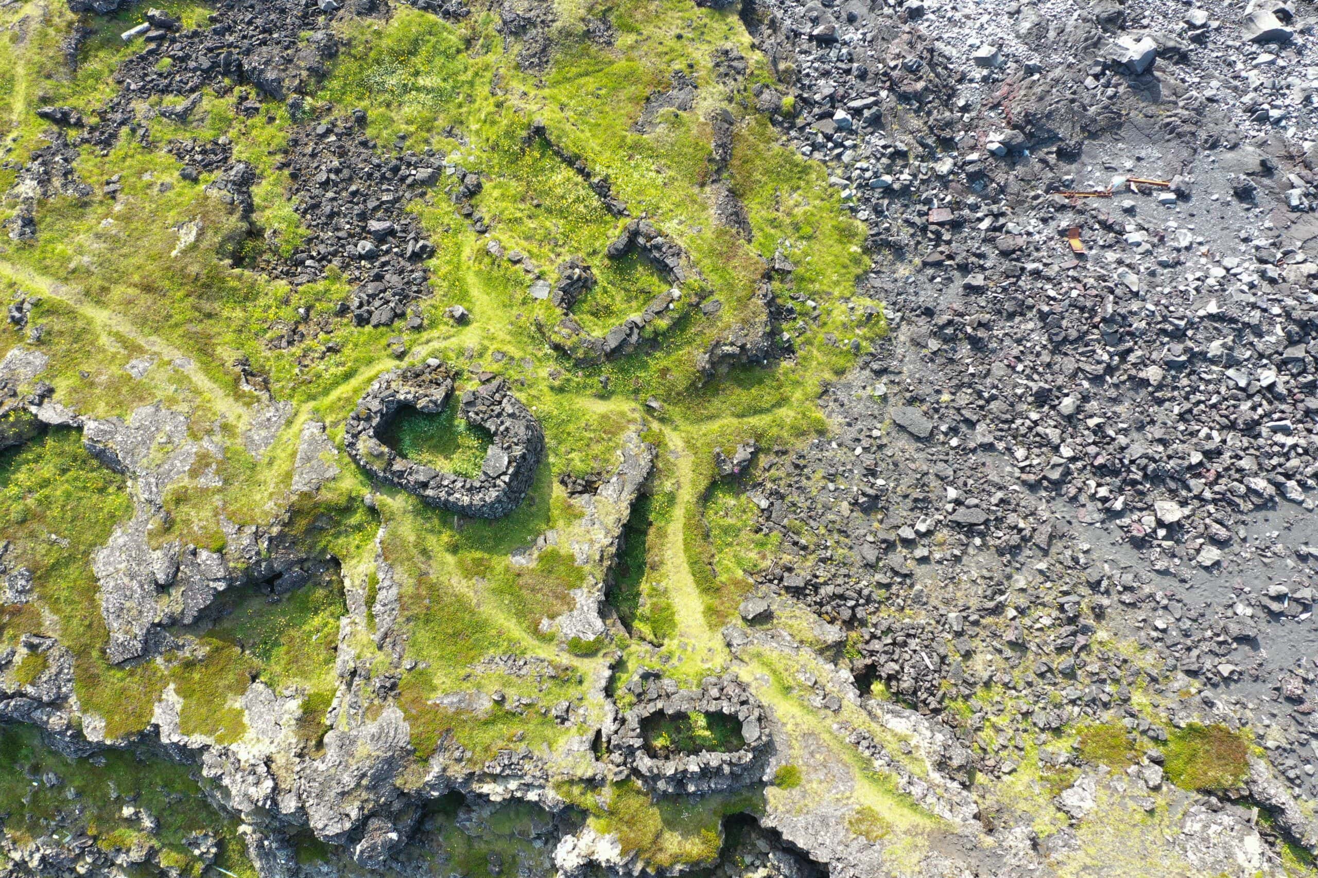
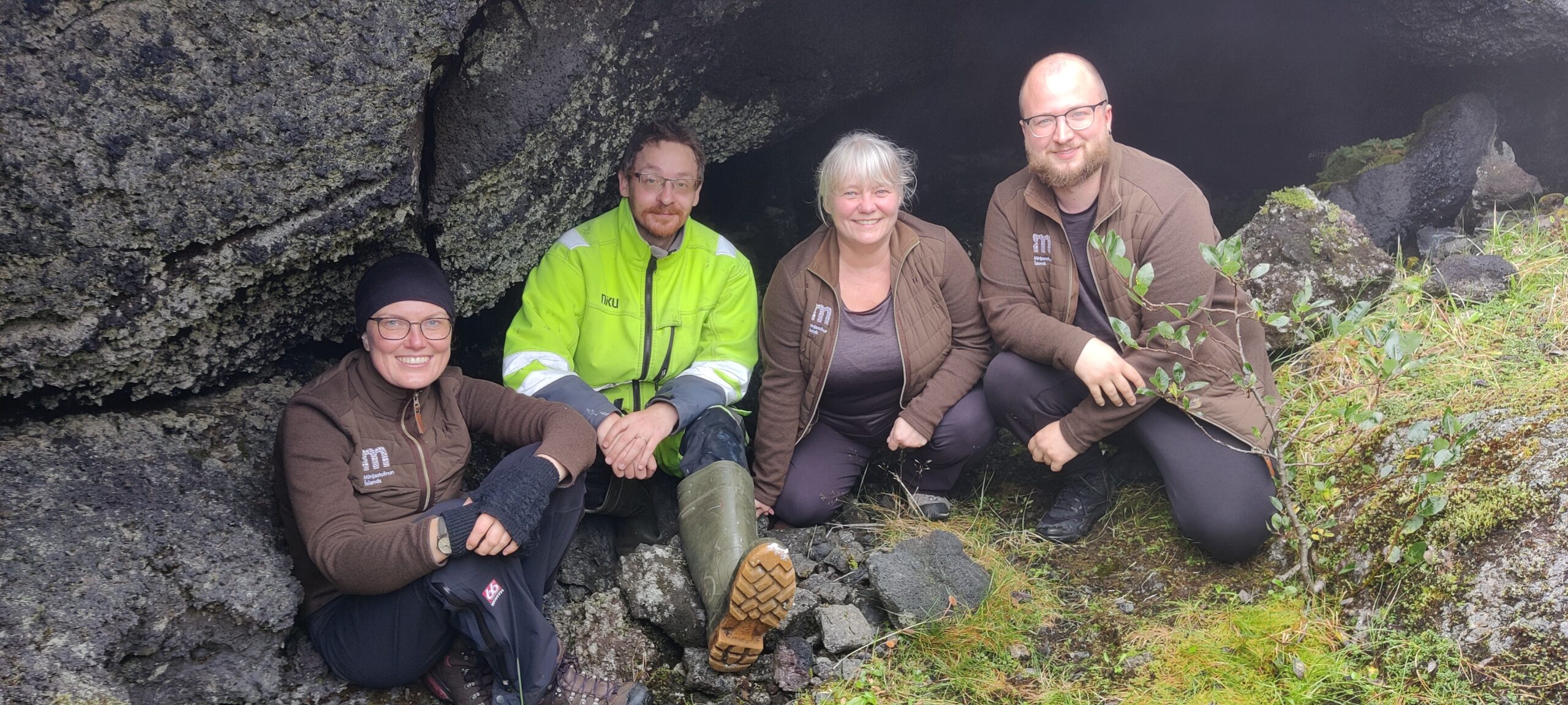
NIKU leads the documentation work, which consist of thousends of images from the ground and from the air. The ground images, taken by Solem (NIKU), Sólrún Inga Traustadóttir, Agnes Stefánsdóttir and Ómar Valur Jónasson (Minjastofnun Íslands) will be used in combinations with drone images to create high-resolution 3D models of three selected cultural landscapes on Reykjanes. The 3D models can be used as a basis for both research and public presentation, and will be invaluable documentation if the cultural monuments should disappear.
Successful mission
-Despite the challenges with accessibility, lava flow and weather, the mission was successful. It was a very good and pleasant collaboration with Minjastofnur Islands, and it is conceivable that similar work can be carried out later. We look forward to presenting the 3D models when they are completed, concludes Solem, adding that he is happy that no drones melted during the mission.