


Thought the monastery was lost: Found the entire complex with ground‑penetrating radar under a football pitch
A medieval monastery complex, long believed to be lost, has now been identified using ground penetrating radar (GPR) in Roskilde, Denmark. The investigations have uncovered extensive and well preserved remains of the St Clare’s Convent from the 13th century, approximately one metre below today’s ground surface.
The investigations were carried out in connection with plans to build an underground parking facility beneath the sports field at Byparken in Roskilde.
Historical sources state that a convent for nuns was located at the site in the Middle Ages, and the museum organisation ROMU (Roskilde Museum) therefore wanted to examine the area more closely using GPR. The method is quick and non‑destructive, and can map structures below ground without excavation.
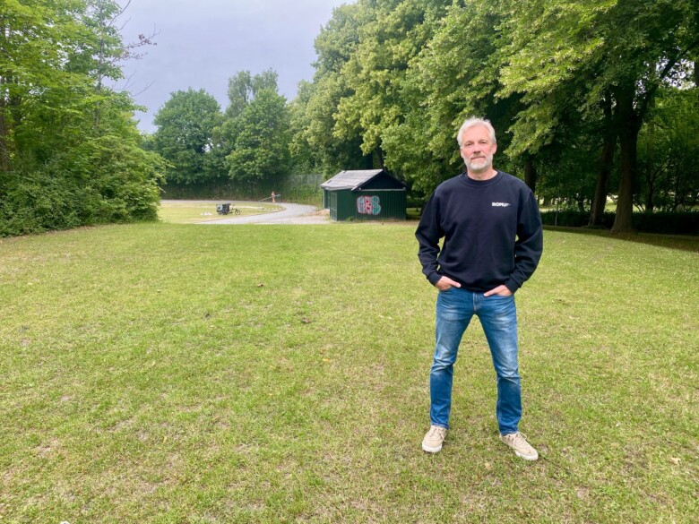
“We knew that St Clare’s Convent had been located here, but not how much of the complex from 1256 had been preserved. The GPR survey has produced very clear results and a solid basis for planning further investigations,” says archaeologist Jesper Langkilde at ROMU.
ROMU
The museum organisation ROMU has its origins in Roskilde Museum, which was established in 1929. Today ROMU operates ten museums in the municipalities of Roskilde, Lejre and Frederikssund.
ROMU is one of ten museums designated at national level by the Agency for Culture and Palaces to oversee Denmark’s protected cultural heritage. The museum is responsible for supervision in central and western Zealand.
Thought the monastery was lost
In the Middle Ages, St Clare’s was one of five monasteries that made Roskilde an important town. Both ecclesiastical and royal power were centred here for many years.
It has long been known that the convent was dissolved and demolished after the Reformation in the 16th century, and that half a million bricks were sold to Selsø Castle. Because of this, it has also been assumed that nothing remained of the complex.
Urban development has meant that today we have only limited knowledge of what the monasteries in Roskilde looked like. The fact that the discovery has been made on an open grass field that has not previously been built over provides a fantastic opportunity to learn more about St Clare’s nunnery and the area in which it was located.
Exceptionally good GPR results
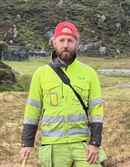
The investigations were carried out in collaboration between ROMU, the National Museum of Denmark and the Norwegian Institute for Cultural Heritage Research (NIKU). The GPR measurements were conducted by NIKU archaeologist Arne Abel Stamnes and Magnus Hjorth Jørgensen from the National Museum, and the interpretation and further processing were carried out by Arne, who has extensive experience with geophysical surveys of cultural heritage sites.
GPR in archaeology
Ground‑penetrating radar (GPR) is used to map structures below the ground without excavation.
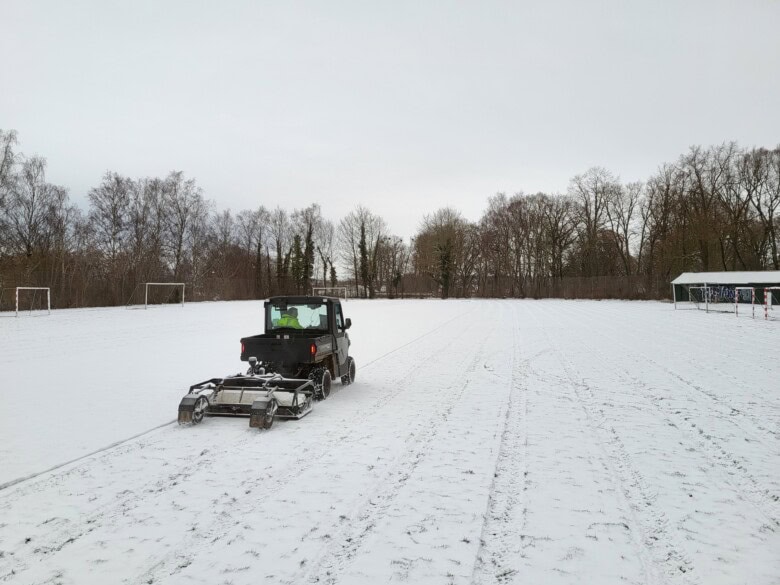
A GPR scanner mounted on an ATV is driven systematically over an area while it sends electromagnetic signals down into the subsurface. When the signals encounter, for example, masonry, ditches or other structures, they are reflected back and recorded by the instrument.
The method can provide very precise results and help archaeologists identify areas that should be examined more closely through excavation.
Geophysics at NIKU
NIKU has almost two decades of experience in research, development and use of geophysical methods in archaeology.
NIKU has previously been a partner in the large international research institute Ludwig Boltzmann Institute for Archaeological Prospection (LBI ArchPro) in Austria, which has now concluded, as well as in an ongoing collaboration with Geosphere Austria and the Vienna Institute for Archaeological Science (VIAS).
The combined experience is now being carried forward in research and heritage management in Norway and abroad, including NIKU’s projects carried out together with the National Museum of Denmark.
NIKU has established a permanent geophysics service in Denmark and has a framework agreement with the National Museum of Denmark for implementing and further developing geophysical surveys.
GPR works by transmitting electromagnetic waves into the ground. When the waves encounter structures with different properties than the surrounding soil, such as masonry or other traces of human activity, the signals are reflected back to the receiver. The results can then be processed into detailed maps of what is hidden beneath the surface.
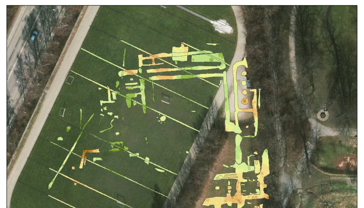
The mapping in Roskilde revealed traces of the monastery buildings, including room divisions, cloisters, and a church in the southern wing. The eastern wing in particular appears to be very well preserved, with clear traces of both vaulting pillars and room divisions.
“The results are simply impressive. GPR data do not always provide such clear images, and often the interpretation requires extensive analytical work,” says Stamnes.
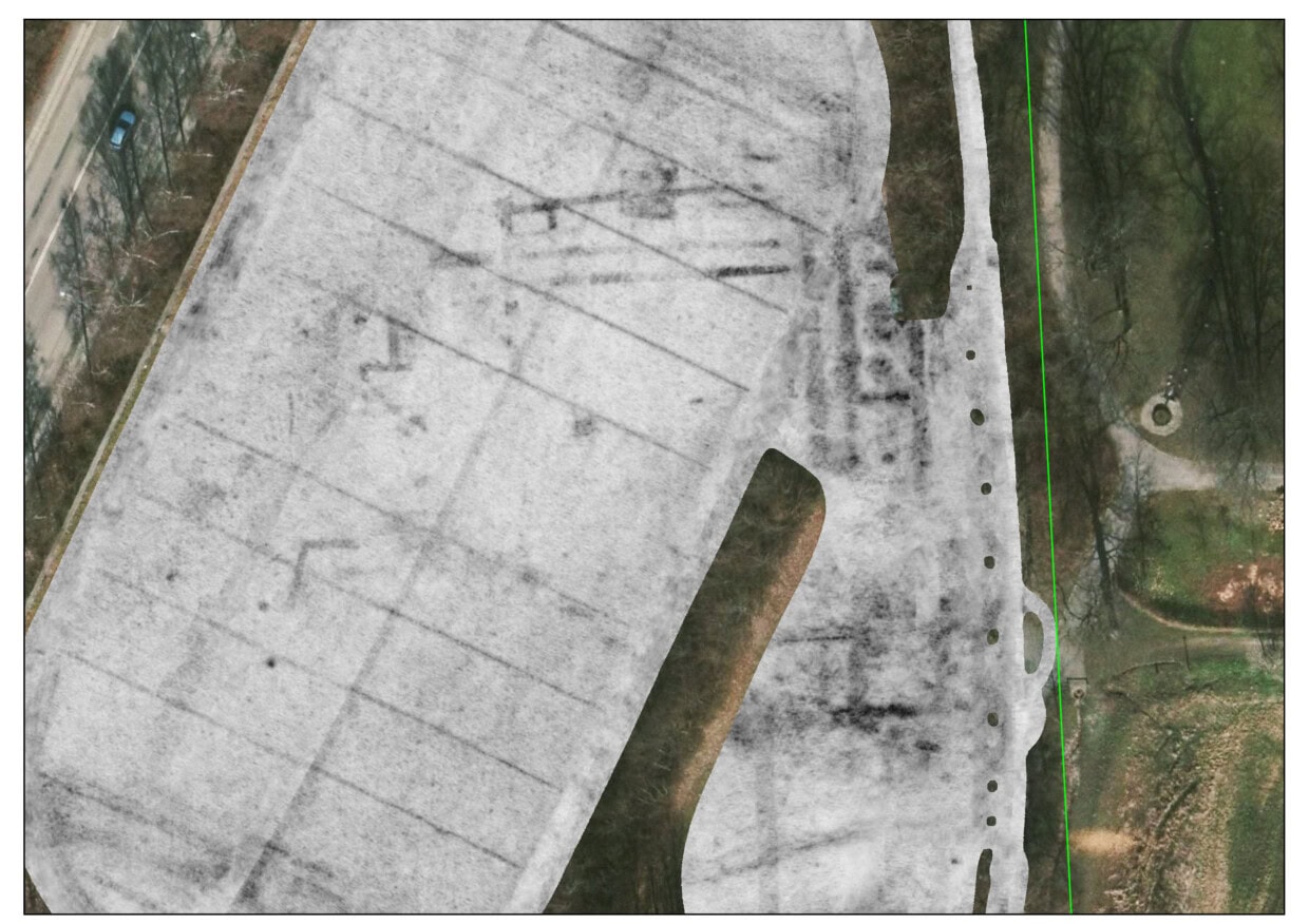
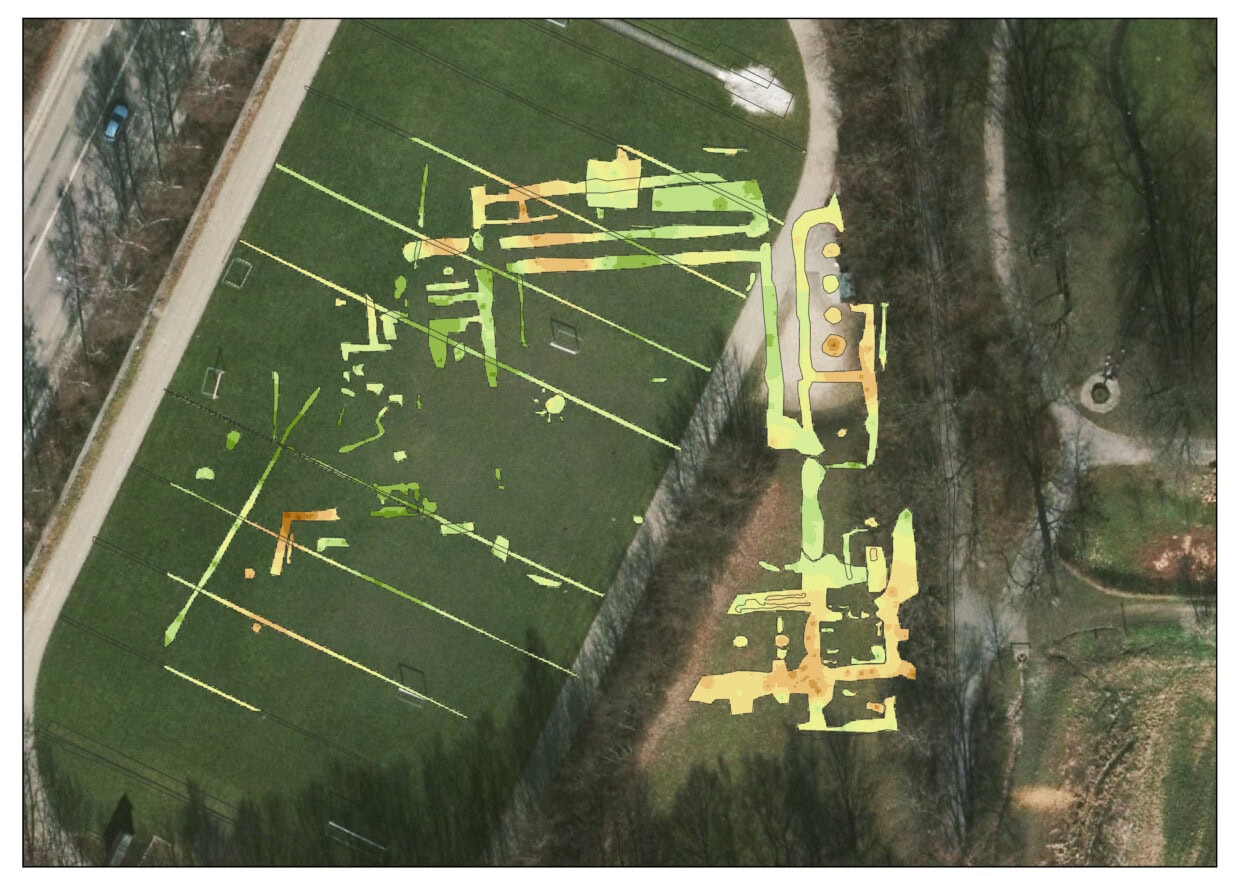
The ground-penetrating radar survey clearly identified remains of masonry and building structures. The monastery's northern and eastern wings, in particular, appear to be remarkably well preserved, with evidence of internal room layouts and the inner cloister. Map: National Museum of Denmark/NIKU.
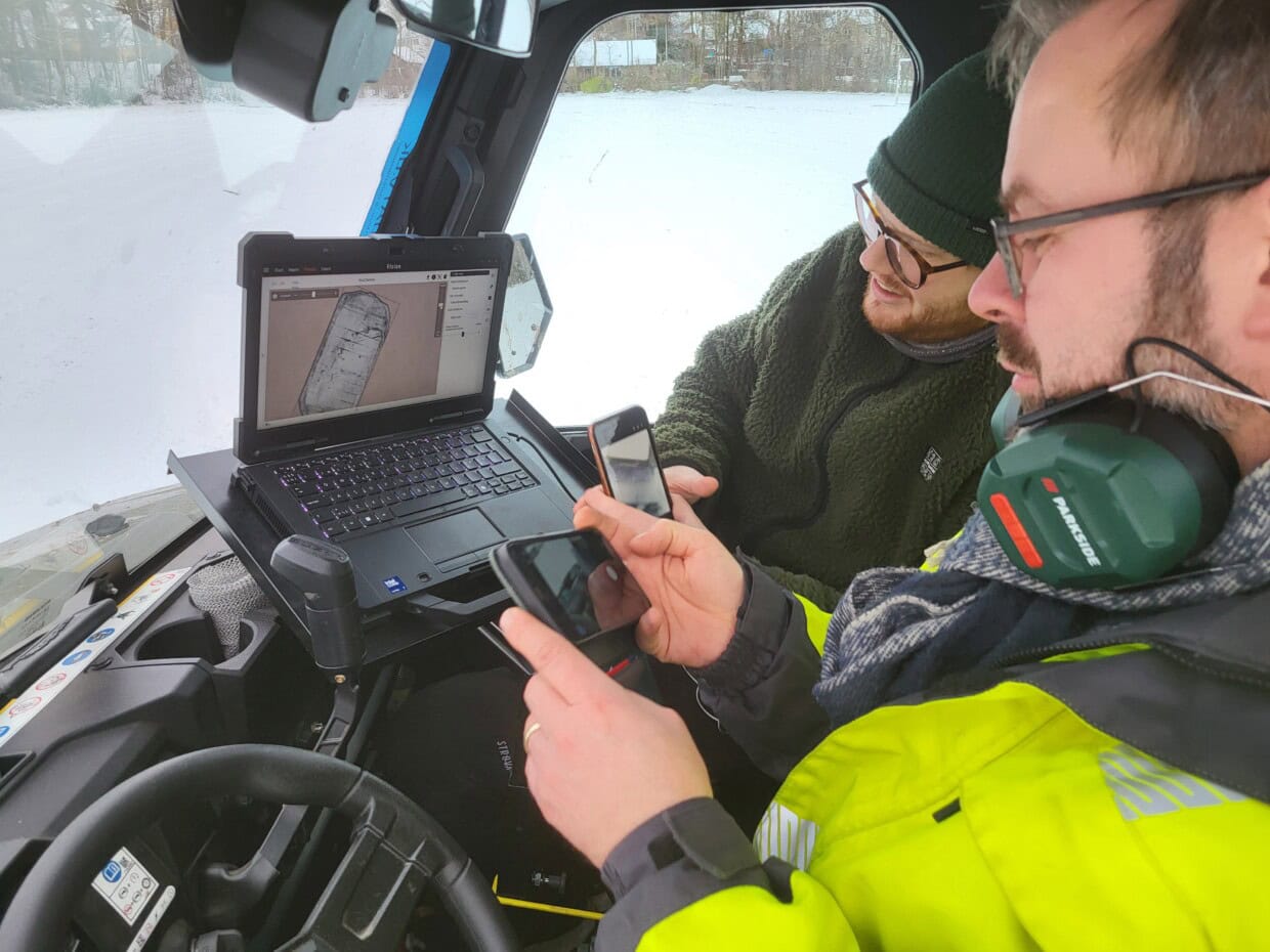
He explains that they were able to see the structures already while they were driving around on the football pitch.
“This is the first time I have documented such a well‑preserved monastery complex with GPR, and in my assessment these are among the clearest GPR results from a monastery complex in Scandinavia.”
A unique basis for further investigations
NIKU’s building archaeologist and monastic expert Regin Meyer agrees with this assessment:
“The depth slices of St Clare’s Convent must be said to be an exceptionally good GPR result over a monastery complex.”
“Here you can see four monastery wings at right angles to each other, forming and delimiting a cloister courtyard. It is also remarkable that so much architecture can be read out of the GPR material, with several room divisions, pillar foundations and characteristic cloisters. In addition, external constructions and buildings outside the monastery square are suggested.”
Meyer believes the results show the potential that still lies hidden underground.
“The dataset clearly shows the building‑archaeological potential that lies beneath the ground surface at this site. The material illustrates the valuable benefit of geophysical surveys for identifying and protecting building remains, and provides an exceptionally good basis for more precise archaeological investigations in the future.”
May provide new knowledge about medieval Roskilde
St Clare’s Convent is the last of the five medieval monasteries known from Roskilde. The other four are protected, while the area where St Clare’s Convent is located is not protected, because it was long assumed that the cultural heritage remains had been lost.
The next step will be trial trenches and archaeological investigations in the area where the parking facility is planned, depending on what the Roskilde municipality decides to do. Together with the GPR results, these investigations will provide a basis for further planning of possible archaeological excavations.
The aim is both to document the cultural heritage and to find solutions that can ensure that the best‑preserved parts of the monastery are preserved for the future.