New ship burial found in Norway
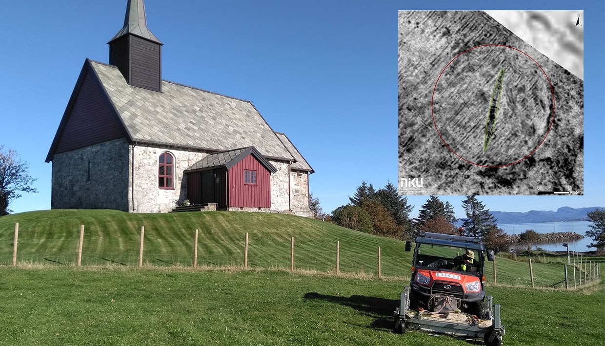
A high-resolution georadar has detected traces of a ship burial and a settlement that probably dates to the Merovingian or Viking Period at Edøy in Møre and Romsdal County in Norway.
The discoveries were made by archaeologists from the Norwegian Institute for Cultural Heritage Research (NIKU)
The archaeological prospection approach using large-scale high-resolution georadar measurements was developed by the LBI ArchPro research institute and its partners, including NIKU, using technology from Guideline Geo.
– This is incredibly exciting. And again, it’s the technology that helps us find yet another ship. As the technology is making leaps forward, we are learning more and more about our past, says Dr. Knut Paasche, Head of the Department of Digital Archaeology at NIKU, and an expert on Viking ships.
– We only know of three well-preserved Viking ship burials in Norway, and these were excavated a long time ago. This new ship will certainly be of great historical significance and it will add to our knowledge as it can be investigated with modern means of archaeology, says Paasche.
More than a thousand years old
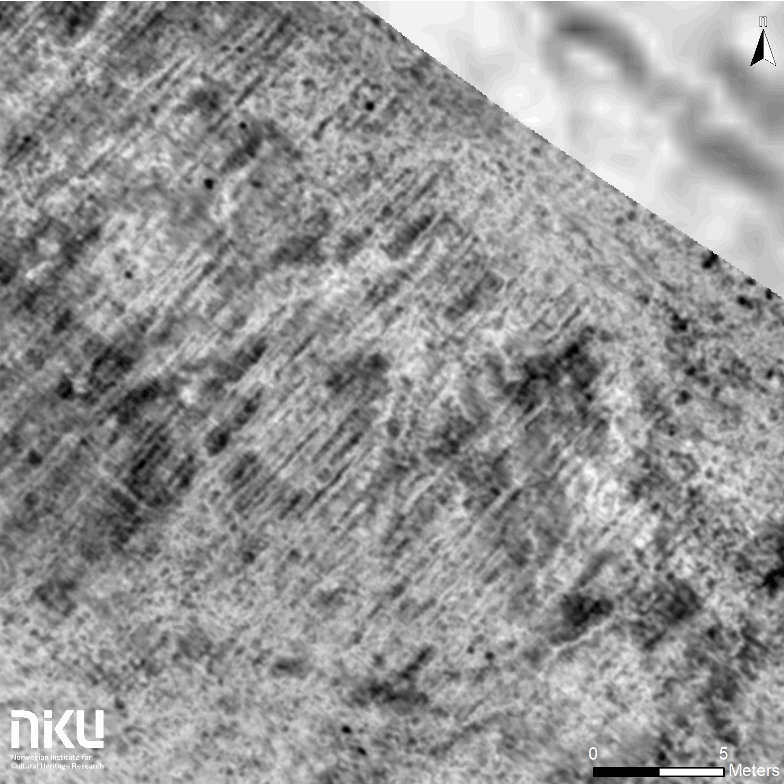
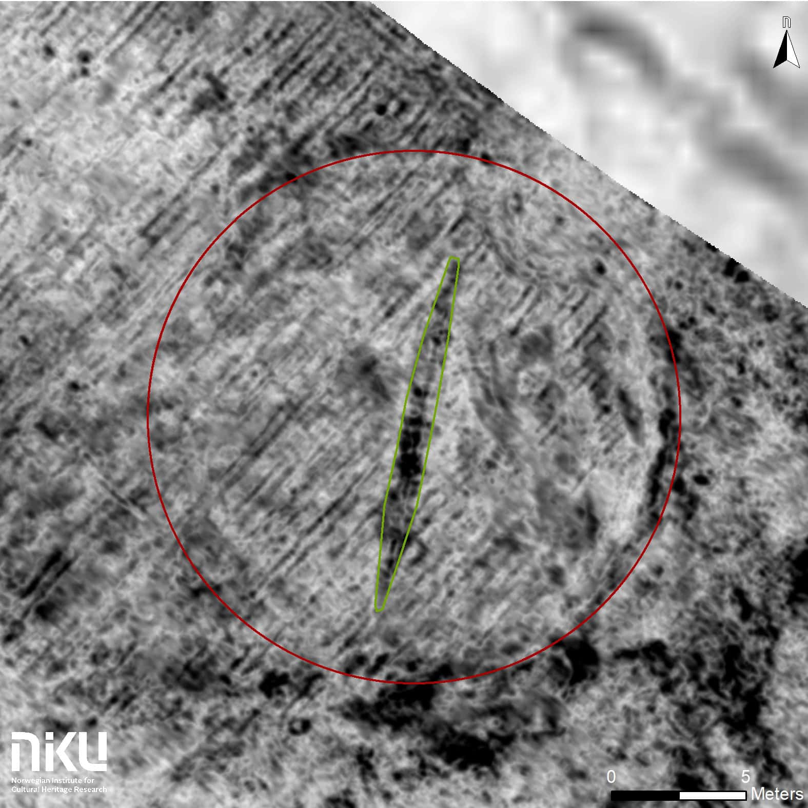
As with the find at Gjellestad in 2018, the remains of the ship are located just below the top soil in an area where there was previously a burial mound. The burial mound appears as a marked circle some 18 metres in diameter in the georadar data. In the middle of the mound, archaeologists can see a 13 metre long keel, and hints of the first two strakes on each side of the keel.
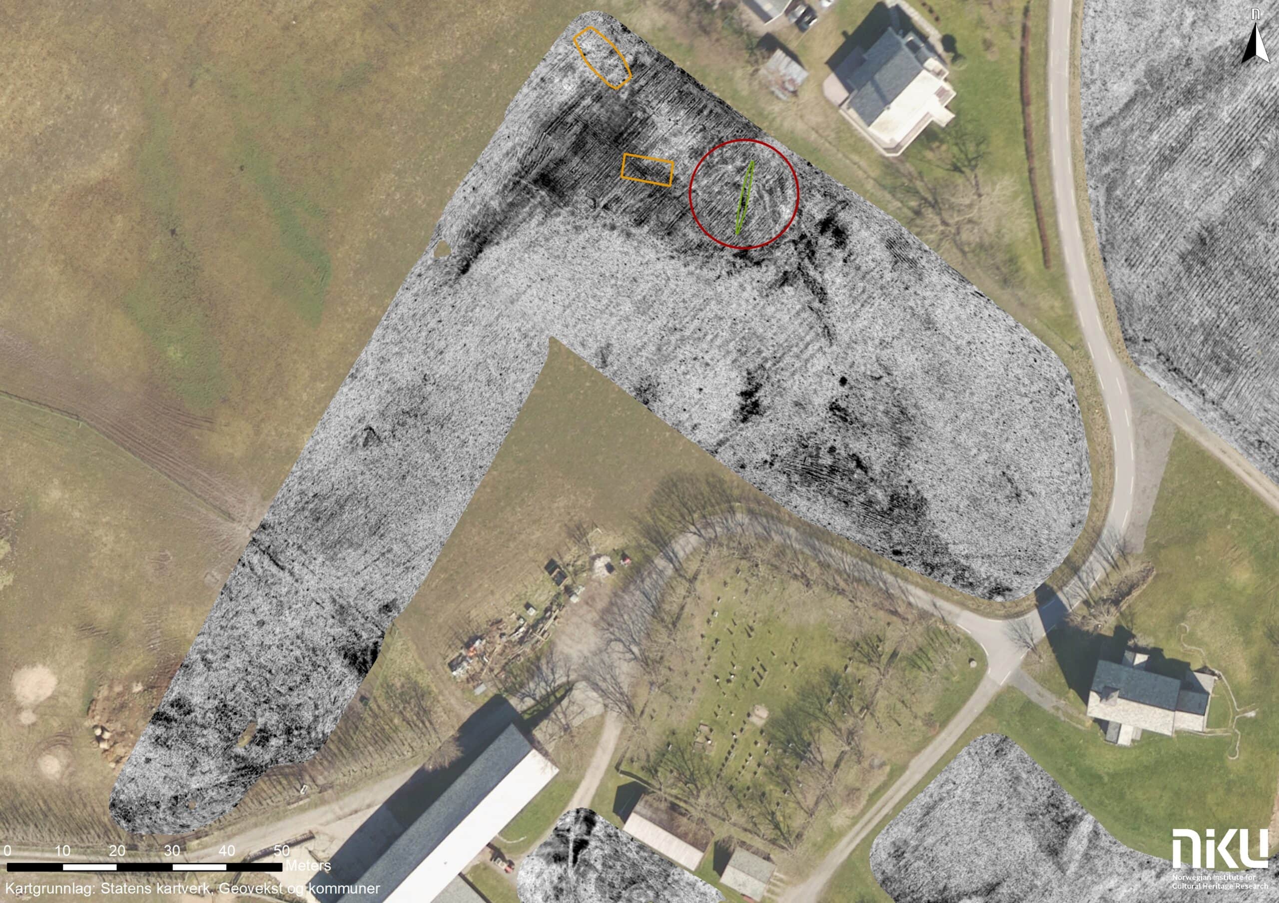
It is likely that it is the traces of the central parts of the ship that are now visible with the help of georadar, while the fore and aft sterns appear to have been destroyed by the plough.
– The length of the keel indicates that the ship may have been a total of 16-17 meters long. It is too early to say anything certain about the age for the ship, but the ship must be from the Merovingian or Viking Period. Which means the ship is more than 1,000 years old, says Paasche.
In addition to the ship, the archaeologists also see traces of settlements in the data although it is still too early to date these.
The surveys at Edøy have been done as a collaboration between Møre and Romsdal County, Smøla municipality and NIKU.
Advanced georadar technology
It was the archaeologists Dr. Manuel Gabler and Dag-Øyvind Engtrø Solem at NIKU who conducted the surveys at Edøy in September and who made the ship discovery.
Following an initiative of Smøla Municipality and Møre and Romsdal County, they surveyed a smaller area around Edøy Church in September last year with promising results. The area of investigation was then expanded, and they went back in September 2019.
– We had actually finished the agreed upon area, but we had time to spare and decided to do a quick survey over another field. It turned out to be a good decision, says Gabler.
In search of the Vikings?
Now the team at NIKU want to explore larger parts of Edøy and the surrounding areas.
– We hope to engage in a research project together with local authorities where we can conduct a larger investigation out here with several non-invasive methods of investigation, says Engtrø Solem.
The team at NIKU are also preparing for future discoveries in Norway, as there are many promising areas of great historical importance that might reveal more secrets.
Gabler and Engtrø Solem used the same georadar system on Edøy that was used in the discovery of the Gjellestad Ship. The radar was developed by Guideline Geo, and the technology around the radar itself and the software used subsequently was developed by NIKU in collaboration with several international partners organized by the Ludwig Boltzmann Institute for Archaeological Prospection and Virtual Archeology (LBI ArchPro).
Press contacts:
NIKU: Archaeologist Dr. Knut Paasche, +47 995 11 510, Thomas Wrigglesworth, +47 958 778 82
LBI ArchPro: Prof. Dr. Wolfgang Neubauer +43 664 8174991 About LBI ArchPro
The Ludwig Boltzmann Institute for Archaeological Prospection and Virtual Archaeology (archpro.lbg.ac.at) is a research institute of the Ludwig Boltzmann Gesellschaft (www.lbg.ac.at) and was founded in 2010. The institute carries out its research activities together with several international partner organisations and aims to create a network of archaeological scientists supporting interdisciplinary research programmes for the development of large scale, efficient, non-invasive technologies for the discovery, documentation, visualisation and interpretation of Europe’s archaeological heritage. The lead partners of the institute based in Vienna are the Ludwig Boltzmann Gesellschaft (A), Amt der Niederösterreichischen Landesregierung (A), University of Vienna (A), TU Wien (A), ZAMG – Central Institute for Meteorology and Geodynamics (A), ArchTron (A), Historical Environment Scotland (UK), 7reasons (A), LWL – The federal state archaeology of Westphalia-Lippe (D), NIKU – Norwegian Institute for Cultural Heritage (N) and Vestfold fylkeskommune – Kulturarv (N).